Satellite imagery posts
Explore the latest in our mission to build a better world using data science and AI.
Explore the latest in our mission to build a better world using data science and AI.
Learn about the winners and winning solutions from the final stages of the Water Supply Forecast Rodeo.
Learn about the winning models for forecasting seasonal water supply from the first stage of the Water Supply Forecast Rodeo.
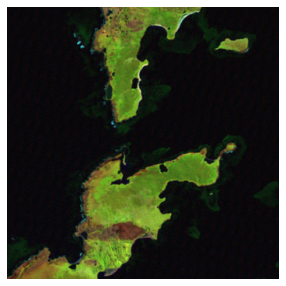
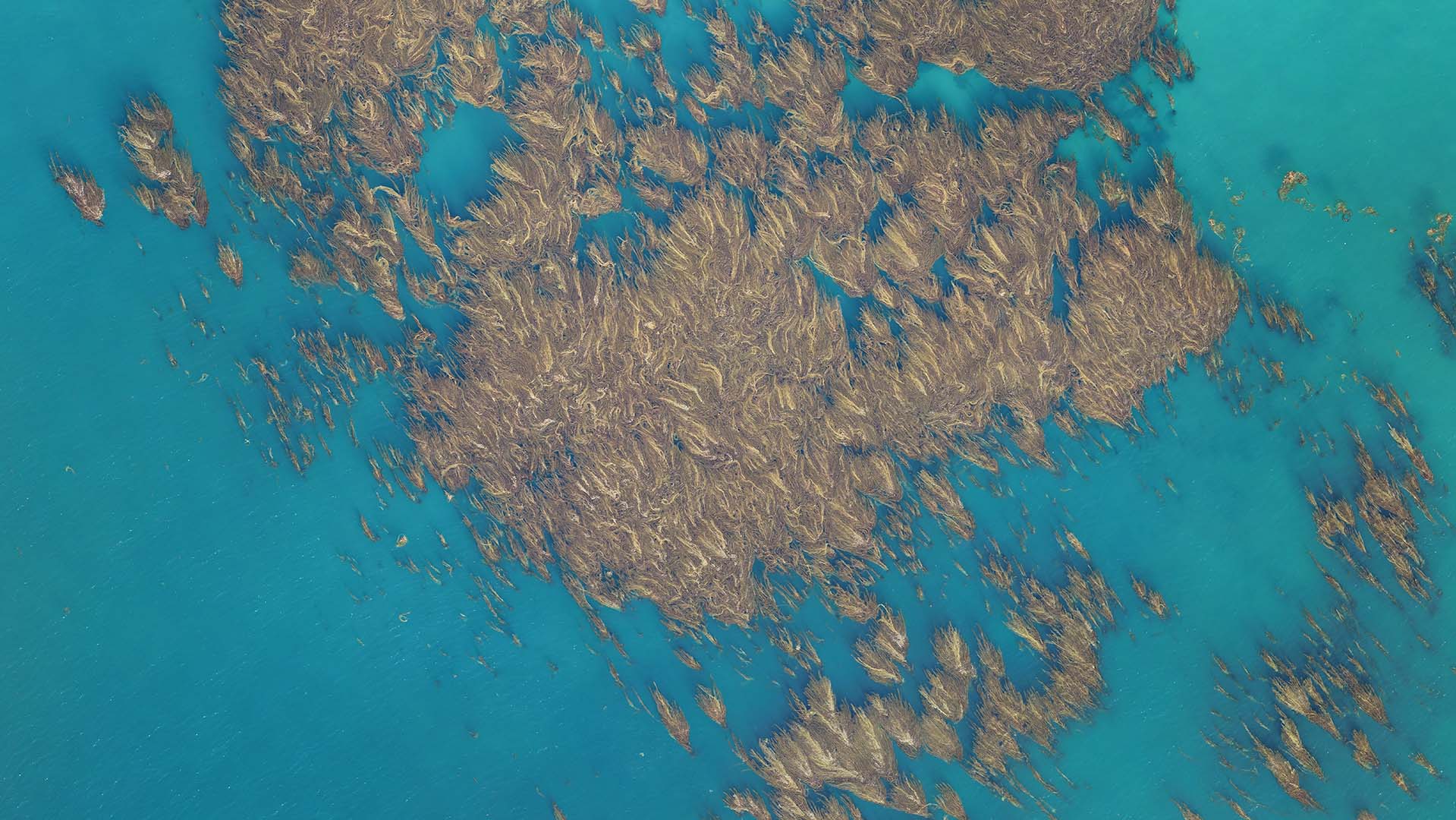
Dive into the solutions from the super segmenters who best detected kelp in Landsat imagery!
There is a huge variety of Earth observation datasets that can help to address our world's most pressing challenge. All the options can be hard to navigate. Learn about some key datasets and resources for getting started!
Feeling overwhelmed by the complexity of satellite data? We've been there. Join one of our data scientists on their learning journey to understand what satellite data is all about!
How can we use data and AI to help combat the effects of climate change? This post walks through real-world examples from DrivenData challenges working with public, private, and social sector organizations.
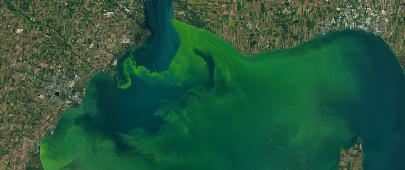
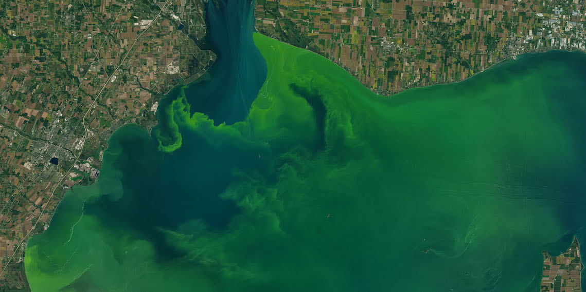
Meet the participants who cracked the code to detect harmful algal blooms! Monitoring cyanobacteria in lakes and reservoirs keeps both the human and marine life that rely on these water bodies safe and healthy.
Meet the minds behind the top models for predicting aboveground biomass using remote sensing data!
We'll show how to use satellite imagery and LightGBM to create a tree-based model predicting harmful algal blooms. This post will help you get started on our new Tick Tick Bloom Challenge!
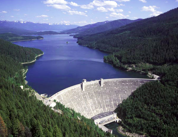
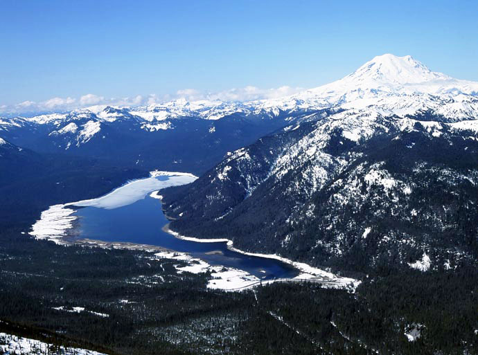
Meet the winners who most accurately estimated snow water equivalent across the Western U.S. in real-time.
Meet the competitors who topped the leaderboards in the NASA Airathon challenge. Their predictions of surface-level air pollution could give millions of people the information required to protect their health.
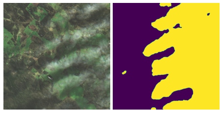
Better identifying and removing clouds from satellite imagery enables a wide variety of environmental applications in disaster recovery, conservation, and more. Get to know the winning participants who advanced state-of-the-art methods in cloud detection!
We'll show you how to preprocess HDF5 files and work with an OMI NO2 data product to estimate air quality around the world!
We'll show you how to preprocess HDF4 files and work with a MAIAC AOD data product to estimate air quality around the world!
We'll demonstrate how to get started predicting cloud cover in satellite imagery for our new competition!
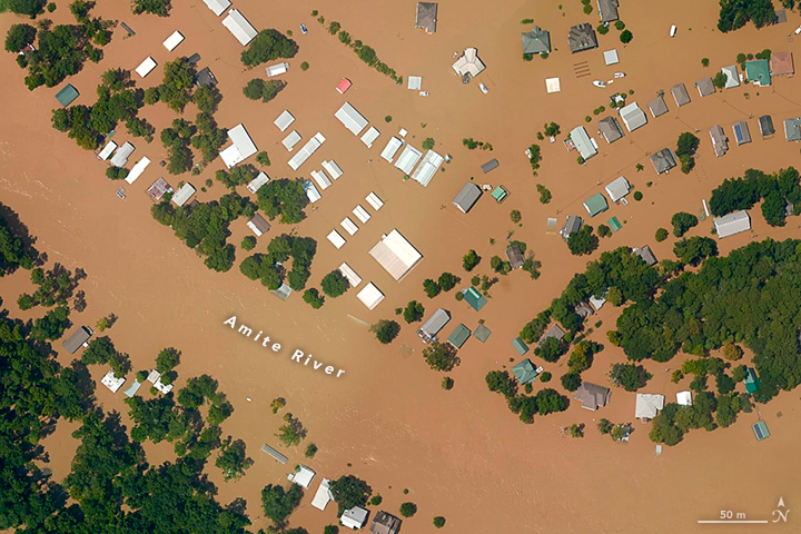
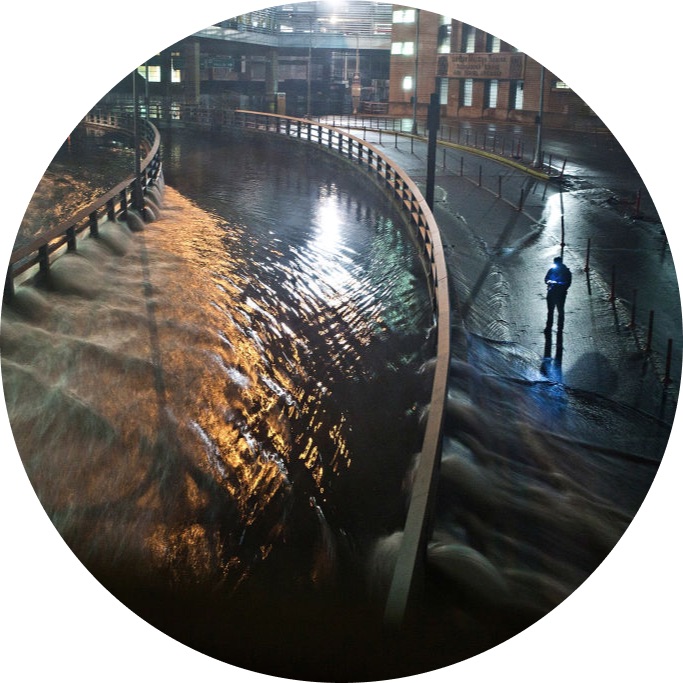
Meet the winners who were best able to detect floodwater using synthetic-aperture radar (SAR) imagery! These winners developed solutions that can help to strengthen early warning systems and direct emergency relief.
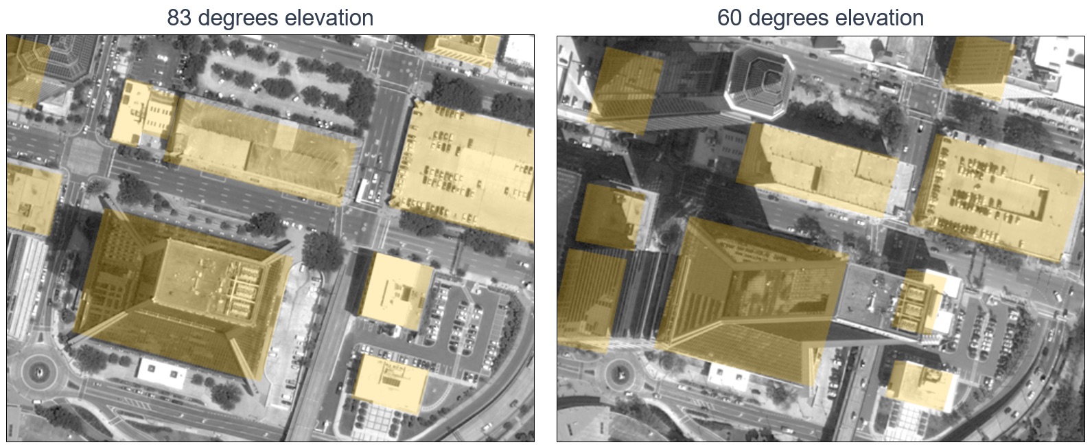
Meet the winners with the best models for mapping oblique satellite imagery to geocentric pose! These winners helped made overhead imagery more useful for time-sensitive applications like emergency response.
We'll show you how to tune a U-Net model to measure flood extent using Sentinel-1 synthetic-aperture radar imagery.
We'll show you how to get started with the residual U-NET benchmark model, a state-of-the-art approach to predicting the height and pose of ground objects for monocular satellite images taken from oblique angles.
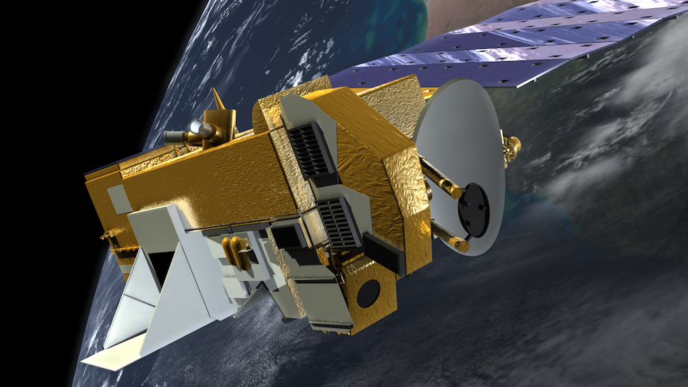
Meet the winners who were best able to predict disturbances in Earth's magnetic field, and hear them explain their creative solutions.
Join our newsletter or follow us for the latest on our social impact projects, data science competitions and open source work.
Learn more about how our team is bringing the transformative power of data science and AI to organizations tackling the world's biggest challenges.